
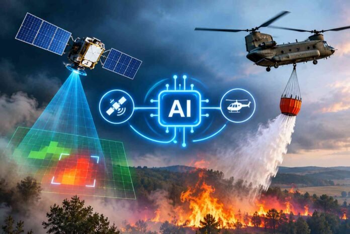
- The UK plans to combine AI, satellite imagery and military aircraft to improve wildfire detection and emergency response.
- Airbus satellites and AI systems could identify heat signatures, dry vegetation and potential wildfire outbreaks earlier.
- RAF Chinook helicopters and A400M aircraft are expected to receive specialist firefighting equipment.
- AI could help protect communities and the environment, although its own energy consumption and infrastructure risks remain concerns.
AI Wildfire Detection UK plans are taking shape as the government looks for new ways to respond to increasingly dangerous wildfires. After a summer of extreme heat and widespread fires, the UK is considering combining artificial intelligence, satellite imagery and military aircraft to identify and tackle blazes before they spiral out of control.
The proposed initiative could bring together technology companies, universities, emergency services and the military to improve the country’s wildfire response. Rather than relying solely on firefighters to identify fires after they have started spreading, the system would use AI to spot early warning signs and help emergency crews respond more quickly.
The plans are expected to be announced by Prime Minister Andy Burnham at a resilience summit hosted at the National Situation Centre. The government is reportedly considering a new AI division within COBRA, its emergency crisis management committee, to coordinate the initiative.
It is an interesting use of AI that goes beyond chatbots, image generation and office productivity tools. When lives, communities and natural environments are at risk, AI could prove genuinely useful by helping emergency services make better decisions and respond faster.
The UK wants AI to identify wildfires before they become disasters
The UK government is looking to bring satellite imagery and AI powered detection systems together to improve wildfire monitoring across the country.
The proposed initiative is expected to involve technology and aerospace companies, including Google, Airbus and VodafoneThree. Universities and other technology organisations could also contribute to developing tools capable of detecting potential wildfire outbreaks.
The objective is straightforward: identify fires earlier, provide emergency crews with better information and reduce the time needed to respond.
Satellite imagery could play a particularly important role. Instead of relying entirely on ground based observations, AI systems could analyse large areas of land and identify signs of unusual heat, changing vegetation conditions or increasing wildfire risk.
That information could then be used to alert emergency services and help them decide where to deploy personnel and equipment.
The government also wants to improve its ability to tackle fires in remote locations, where traditional firefighting methods may struggle.
This is where military aircraft could become particularly useful. According to the reported plans, Royal Air Force Chinook helicopters and Airbus A400M Atlas aircraft will be equipped with specialist firefighting equipment.
Defence Secretary Wes Streeting said the RAF would provide greater support to emergency services as the threat of wildfires grows, including protecting military training areas.
The aircraft could help firefighters reach locations that are difficult to access from the ground, providing another layer of support when fires spread across large areas.
Satellites and AI could give firefighters an important head start
One of the most promising aspects of the initiative is the use of satellite technology to identify potential fires before they become widespread.
Airbus already operates satellite systems capable of monitoring environmental conditions, including forest dryness and heat signatures that could indicate emerging wildfire activity.
AI could help process this information much faster, allowing authorities to identify patterns and potential threats across large geographical areas.
The technology is not entirely new, either.
NASA launched a satellite earlier this year featuring an AI geospatial foundation model developed with IBM. The system uses the open source Prithvi model, which can analyse Earth observation data for applications such as wildfire detection, flood monitoring and landslide identification.
Beyond identifying disasters, the model can also help assess vegetation, biomass and other environmental characteristics.
This information could improve our understanding of how wildfires develop and spread, potentially helping authorities identify locations where fires are more likely to become dangerous.
For firefighters, having access to this information could make a significant difference.
Instead of discovering a fire after it has already spread across a large area, emergency crews could receive an earlier warning and prepare a response while the situation remains manageable.
Of course, satellite detection alone will not prevent every wildfire. Weather conditions, terrain, vegetation and the availability of firefighting resources will continue to influence how quickly a blaze can be contained.
However, combining AI detection with aircraft and emergency response teams could give authorities a much better chance of controlling fires before they become major disasters.
The UK’s wildfire crisis shows why better technology matters
The proposed initiative follows an exceptionally difficult summer for the UK, which reportedly experienced its hottest summer on record.
Wildfires destroyed thousands of acres of land, forcing emergency services to respond to widespread outbreaks. The situation became serious enough for a nationwide emergency alert to be issued.
One particularly concerning incident involved a wildfire that spread within kilometres of the Sizewell B nuclear power station.
Events like these highlight how vulnerable communities and critical infrastructure can become when extreme heat and dry conditions combine.
Traditional firefighting resources can quickly become stretched when multiple fires break out simultaneously. Ground crews may struggle to reach remote locations, while emergency services need to prioritise the most dangerous incidents.
AI could help address some of these challenges by improving situational awareness and helping authorities allocate resources more effectively.
The technology could also provide useful information about changing environmental conditions, allowing emergency planners to prepare for periods of heightened wildfire risk.
However, successful implementation will depend on more than simply installing AI software.
Authorities will need reliable satellite data, well trained personnel, dependable communication systems and clear procedures for responding to AI generated alerts.
The system must also avoid false alarms and ensure that emergency crews can trust the information they receive.
AI could help protect the environment, but its own footprint remains a concern
There is an uncomfortable contradiction in using AI to fight environmental disasters while the technology itself contributes to growing energy demand.
AI data centres require substantial amounts of electricity, and the rapid expansion of the industry has raised concerns about its environmental impact.
The original report also highlights research suggesting that many AI data centres are located in areas exposed to natural disasters.
That creates an obvious question: is the AI industry helping protect the planet, or is it increasingly vulnerable to the same environmental threats it hopes to address?
The answer is not necessarily one or the other.
AI can provide meaningful environmental benefits when it is used to detect wildfires, monitor ecosystems, predict floods and support disaster response. At the same time, its energy consumption and infrastructure requirements need to be managed responsibly.
The UK wildfire initiative offers a practical example of how AI could be deployed for a clear public benefit.
Rather than using AI simply because it is fashionable, the government is looking at a problem where faster information and better decision making could have a direct impact on people’s lives.
That is arguably one of the strongest arguments for investing in the technology.
If AI can help firefighters identify dangerous blazes earlier, protect communities and reduce environmental damage, then this is exactly the sort of application worth pursuing.
The technology still needs to prove itself in real world conditions, but combining AI with satellites, military aircraft and emergency services could represent a meaningful step forward in wildfire prevention and response.
Follow TechBSB For More Updates